What happens when you take the bureaucracy and incompetence out of our public transit system and simply envision what could be? Well, NYC based cartographer, Andrew Lynch, has done just that.
His creation is a subway map that visualizes subway lines that services the more “remote” areas of the NYC metro area.
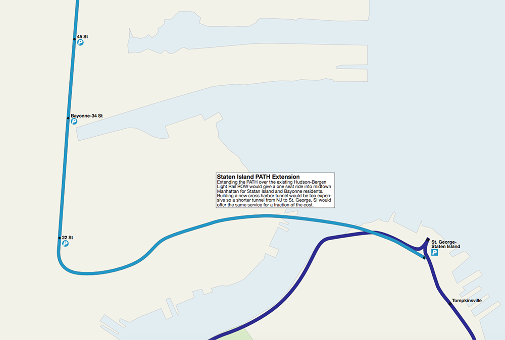
Although most of the improvements center around Manhattan and Brooklyn transit lines, New Jersey got some love too. Lynch, built into his project what he calls “a new Staten Island branch” of the PATH that splits off at the Grove Street station and continues south through Jersey City and Bayonne before connecting to the existing subway system in Staten Island.
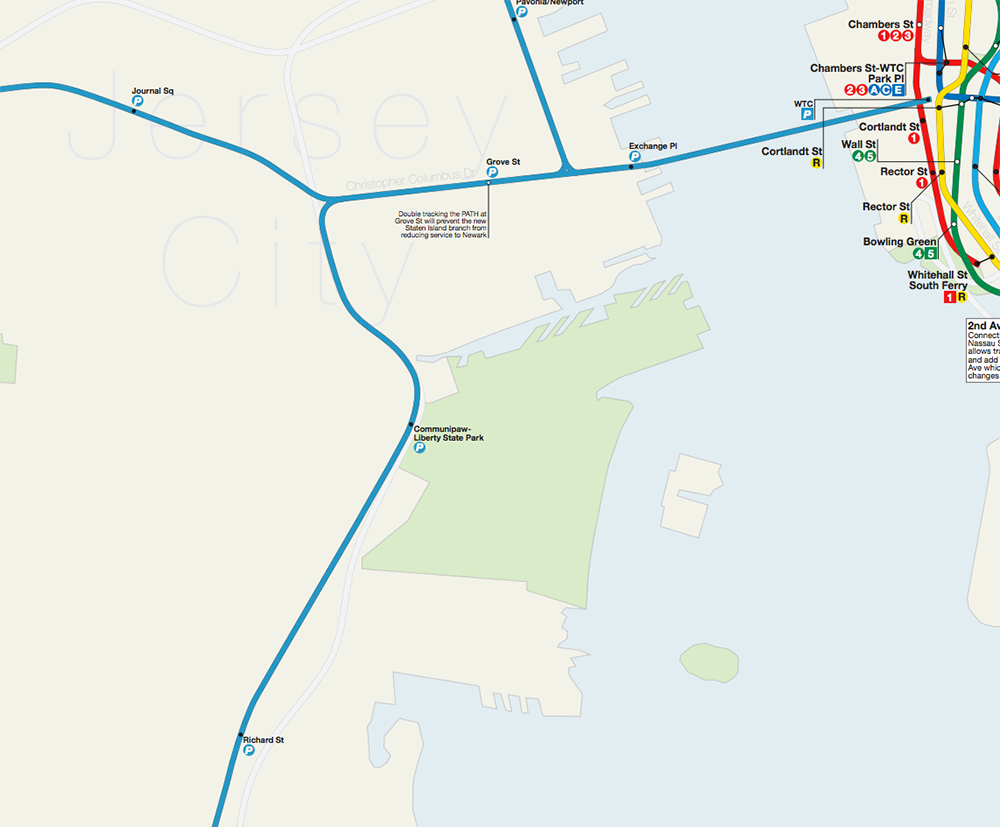
His plan involves “purchasing the track from the Hudson-Bergen light rail and upgrading it for PATH trains.” And although it follows the existing light rail line, the new extension would “give a one seat ride into midtown Manhattan for Staten Island and Bayonne residents.” He acknowledges that building a new cross harbor tunnel would be way too costly, so instead he incorporated a shorter tunnel linking Bayonne and Staten Island.